← Equipment
Positioning
DJI D-RTK 3
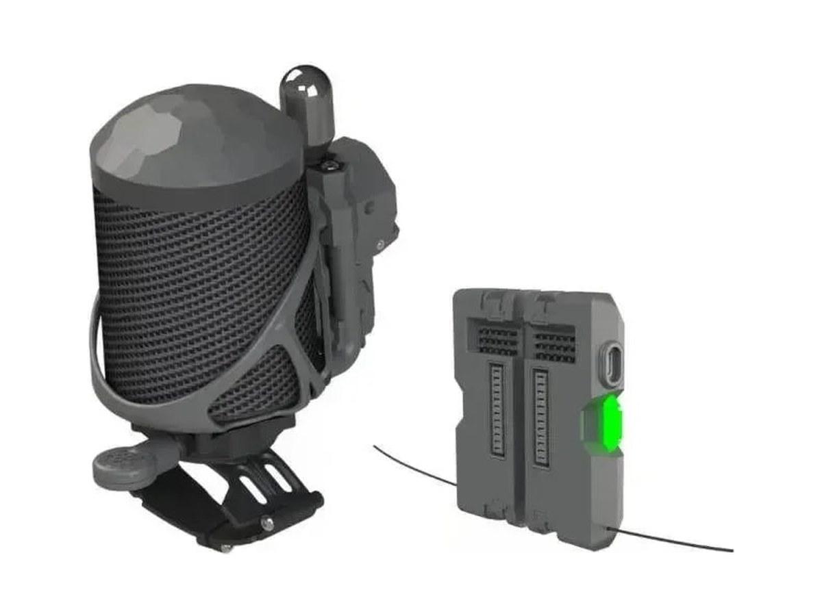
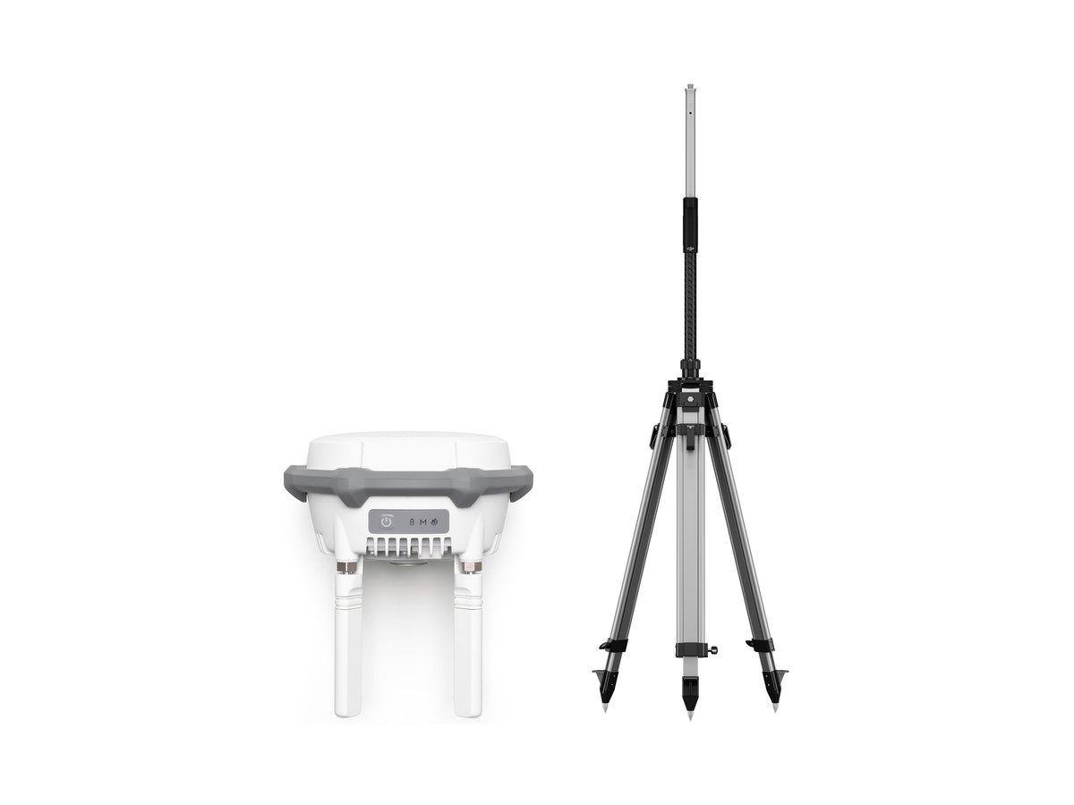
GNSS multifunctional station with survey pole and tripod kit: RTK base station for the drone, relay station to extend the link, and rover to measure ground control and check points (0.8 cm + 1 ppm horizontal, DJI data).
Specifications
Official DJI data.
GNSS Receiver
6 items
- GNSS Frequency
- GPS: L1C/A, L2C, L5BDS: B1I, B2I, B3I, B1C, B2a, B2bGALILEO: E1, E5a, E5b, E6GLONASS: L1, L2QZSS: L1C/A, L2C, L5L-Band
- Accuracy in Base Station and Relay Station Mode
- Single Point Accuracy (Uncalibrated): Horizontal 1.5 m (RMS), Vertical 3.0 m (RMS)Satellite-Based Differential Accuracy: convergence time 20 mins, Horizontal 30 cm (RMS), Vertical 40 cm (RMS)Network RTK Calibration: Horizontal 1.0 cm (RMS) + 1 ppm, Vertical 3.0 cm (RMS) + 1 ppmBase station calibration coordinate accuracy depends on various factors. For surveying, high-precision flight paths, etc., it is recommended to calibrate during periods of inactive ionosphere, in open, unobstructed environments with no electromagnetic interference or multipath effects, using four or more GNSS systems.
- Accuracy in Rover Station Mode
- RTK Accuracy (Fixed Survey): Horizontal 0.8 cm (RMS) + 1 ppm, Vertical 1.5 cm (RMS) + 1 ppmRTK Accuracy (Tilt Survey): 0° to 60°, Horizontal 8 mm + 0.7 mm/° tilt (accuracy <2 cm within 30°)Measurement accuracy depends on various factors. This value is obtained under normal conditions with an unobstructed view, good satellite distribution, low ionospheric activity, and no electromagnetic interference or multipath effects.Intense vibrations and rapid rotations can affect the accuracy of the inertial measurement unit.
- Satellite-Based Precise Point Positioning
- Supported Frequencies: BDS B2b, GALILEO E6, L-BAND (L-band will be supported in later versions)Convergence Time: 20 minsHorizontal: 30 cm (RMS)Vertical: 40 cm (RMS)
- Differential Data Transmission Format
- When used as a base station or relay station, records RTCM 3.2 raw observation data in DAT format.In rover station mode or in calibration mode: supports RTCM v3.0, v3.1, v3.2, v3.3, MSM4, MSM5, MSM6, MSM7; receivers supporting four or more GNSS systems are recommended.
- Initialization Reliability
- >99.9%
Transmission
10 items
- Video Transmission System
- O4 Enterprise
- Operating Frequency
- Relay Station Mode: 2.4 GHz/5.2 GHz/5.8 GHzBase Station Mode: 2.4 GHz/5.8 GHzRover Station Mode: BLE 2.4 GHzOperating frequency allowed varies among countries and regions. Please refer to local laws and regulations for more information.
- Transmitter Power (EIRP)
- 2.4000-2.4835 GHz: <33 dBm (FCC), <20 dBm (CE/SRRC/MIC)5.150-5.250 GHz: <23 dBm (CE/FCC)5.725-5.850 GHz: <33 dBm (FCC), <30 dBm (SRRC), <14 dBm (CE)
- Bluetooth
- Bluetooth 5.1, 2.400 GHz to 2.4835 GHz, Transmitter Power (EIRP) <10 dBm
- Max Transmission Distance in Base Station Mode (unobstructed, free of interference)
- With Matrice 400: 40 km (FCC), 20 km (SRRC/CE/JP)With other aircraft: 15 km (FCC), 12 km (SRRC), 8 km (CE/JP)Rover Station Mode, to mobile devices: 30 mMeasured in an unobstructed outdoor environment free of interference, for one-way, non-return flights under each standard.
- Max Transmission Distance in Relay Station Mode (unobstructed, free of interference)
- FCC: 25 km between the aircraft and the relay stationSRRC: 12 km between the aircraft and the relay stationCE: 10 km between the aircraft and the relay stationBetween the relay station and the remote controller/DJI Dock 3: recommended within 1 km, maximum 3 km (FCC and SRRC); recommended within 300 m, maximum 1 km (CE)
- Max Transmission Distance (unobstructed, with interference)
- Strong interference (city centers): approx. 1.5-5 kmMedium interference (suburban areas): approx. 5-15 kmMicro interference (remote areas/seasides): approx. 15-25 kmData tested under FCC standards; for reference only.
- Max Transmission Distance (obstructed, with interference)
- Low interference, obstructed by buildings: approx. 0-0.5 kmLow interference, obstructed by trees: approx. 0.5-3 kmData tested under FCC standards; for reference only.
- Relay Station Range Extension Effect
- Severe obstruction (e.g., buildings, mountains): 3x to 5x performance improvementMild obstruction (e.g., trees, glass): 1x to 3x performance improvementThe relay station must be deployed in an elevated, unobstructed location free of interference.
- Antenna
- OcuSync 4 directional antennas × 4, 2T4R, standard reverse polarity SMA connector
Power and Battery
5 items
- Power
- Relay Station: 14.5 WBase Station: 7 WRover Station: 6.2 WMaximum power consumption without heating. When connected to a USB-C power supply above 9V, maximum power consumption with heating is 36.5 W.
- Power Port
- USB Type-C
- Supported Power Adapter
- USB PD 3.0 protocol, output voltage 9V to 15V adapter (e.g., DJI 65W Portable Charger)With a 5V-output charger, the D-RTK 3 can be charged only after powering off.
- Battery Operating Time (Under Normal Temperature)
- Relay Station: 4 hrsBase Station: 7 hrsRover Station: 10 hrsBattery performance may decrease in low temperatures; it is recommended to use power adapters that support the USB PD 3.0 protocol.
- Battery
- LiPo, 6500 mAh, 46.8 Wh
Physical Characteristics
6 items
- Operating Temperature
- -20° to 55° C (-4° to 131° F)
- Altitude
- 6000 m
- Protection Rating
- IP67Measured in a controlled environment. The IP rating is not permanently effective and may decrease due to product wear and tear. Ensure all rubber port covers are properly installed.
- Drop Resistance
- 2 m drop with pole
- Dimensions
- 163 mm × 89 mm (without OcuSync Directional Antennas)
- Weight
- Approx. 1.26 kg
In the Box
3 items
- D-RTK 3 Multifunctional Station
- 1
- Spare OcuSync Directional Antennas
- 4
- USB-A to USB-C Cable
- 1
D-RTK 3 Survey Pole and Tripod Kit
5 items
- In the Box
- Self-locking Survey Pole × 1Dual-lock Tripod × 1
- Survey Pole
- Height: 125 cm to 200 cm (without the 5/8" thread)Weight: 900 g
- Tripod
- Height: 92 cmWeight: 2800 g
- Package
- 245 × 245 × 1398 mm (L×W×H), 4.96 kg
- Compatibility
- D-RTK 3 Multifunctional StationD-RTK 3 AG