Temperatures corrected shot by shot
Distance is not a fixed value set once: it comes from each frame's altitude. With emissivity and humidity declared in the report, not left at factory defaults.
Nadir — our processing software
Nadir is the program that turns shots into orthophotos, terrain models and temperature maps. It runs on our own machines: nothing uploaded to third-party services, no subscription to foreign platforms, no copy of your surveys on a server we know nothing about. It exists because two jobs that matter — thermal and vehicles in the middle of the field — were left unsolved by the standard chain.
DJI's official thermal utility needs to know your distance from the target. If you do not tell it, it uses 5 metres. But you shoot a roof from eighty. Measured on our own shots:
Roughly 2.4 degrees of systematic error, always in the same direction. On a thermal survey that is the difference between «fine» and «it is heating up». Nadir reads the altitude written in each shot's metadata and passes it as the distance, frame by frame.
| Distance set | Mean temperature |
|---|---|
| 5 mdefault distance | 13,78 °C |
| 25 m | 13,14 °C |
| 100 m | 11,39 °C |
| 300 msaturates: same as 100 m | 11,39 °C |
Distance is not a fixed value set once: it comes from each frame's altitude. With emissivity and humidity declared in the report, not left at factory defaults.
Masking single photos is not enough: if the detector misses a car in even two shots, it stays in the model. Nadir finds it on the finished orthophoto, rebuilds the ground underneath and regenerates model and orthophoto.
Detected shapes are confirmed or discarded one by one, by hand, and only then applied. A car removed by mistake is a hole in the terrain you deliver.
Missing shots, wrong altitudes, insufficient overlap: caught before eight hours of computation, not after.
Parameters, conditions, limits. The sheet a surveyor attaches when somebody questions a figure.
Beyond point cloud and mesh, gaussian splatting: a model you turn in the browser with nothing to install, useful for showing the job to people who do not open a CAD.
First the program itself: the job queue and the processing chain, with the time each step takes. Then what a finished inspection looks like — the model says where to look, the close-up says what is there. The two work as a pair: without the first you do not know where to go, without the second you have no evidence.
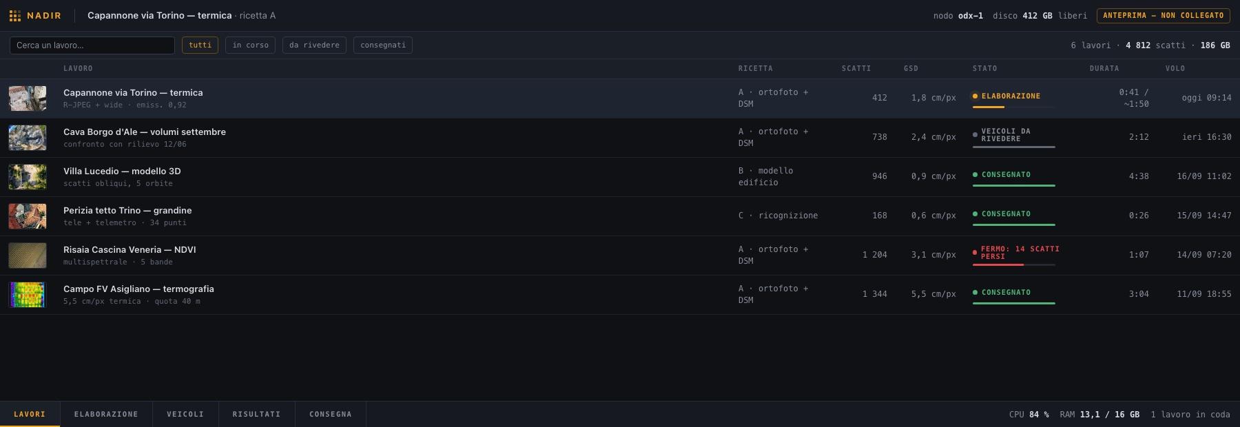
The job queue
Every row is a flight: processing recipe, number of frames, ground detail, state and duration. Two seconds tell you what is running, what is waiting for a manual confirmation and what has stopped — here, the rice-field job halted because 14 frames are missing. A job that stalls is found here, not on delivery day.
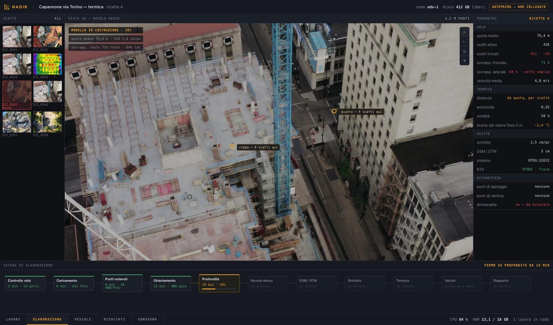
The processing chain
At the bottom the steps in a row, each with its own time: flight check, loading, feature points, orientation, depth, then point cloud, terrain models, orthophoto, thermal. On the right the parameters read from the frames, not typed in by hand — and at the end the row that matters: accuracy «declarable: no — to be measured», because without ground control points you do not write down a precision figure.
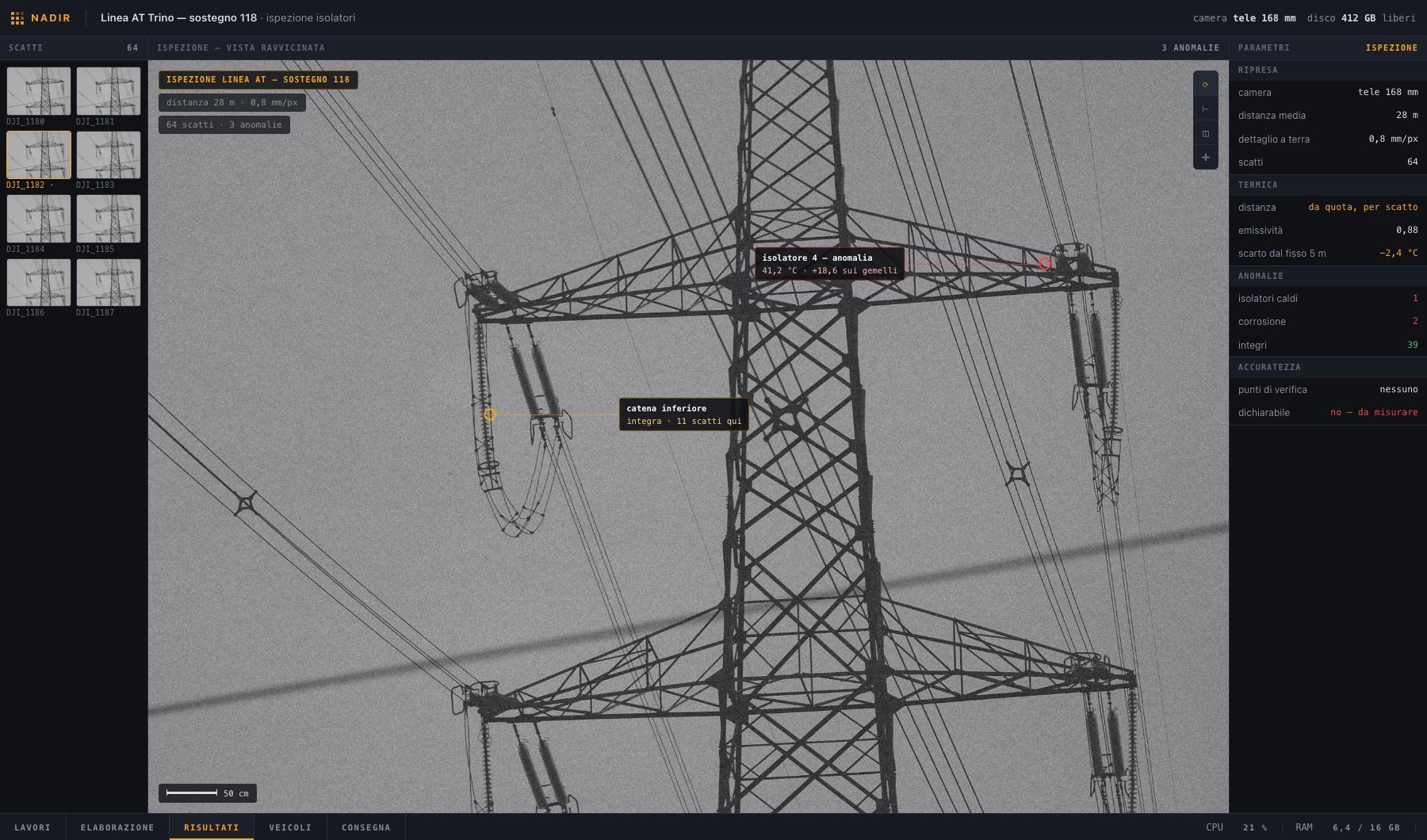
High-voltage transmission tower
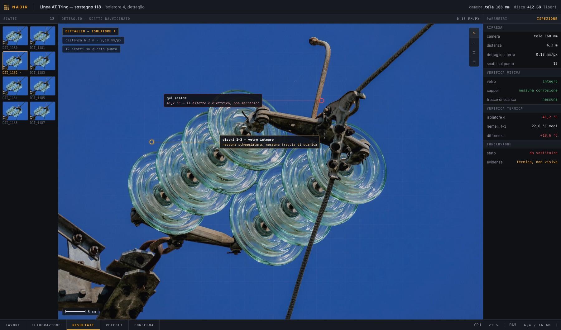
Every insulator checked and marked. The one at top right runs 18.6 degrees hotter than its twins on the same string: that is how a failing insulator gives itself away, because the eye cannot see it.
The same insulator, up close
Glass intact, caps free of corrosion, no flashover marks. The fault is there all the same, and it is electrical: only thermal imaging finds it. This is why an inspection with a camera alone would have called it sound.
A roof with holes in it
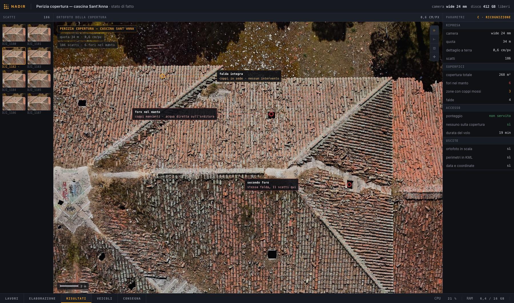
Six holes in the covering across 268 m² of roof: missing tiles, meaning water straight onto the structure. From the courtyard not one of them is visible. The loss adjuster attaches a scaled, dated, georeferenced image instead of a written description.
The same roof, up close
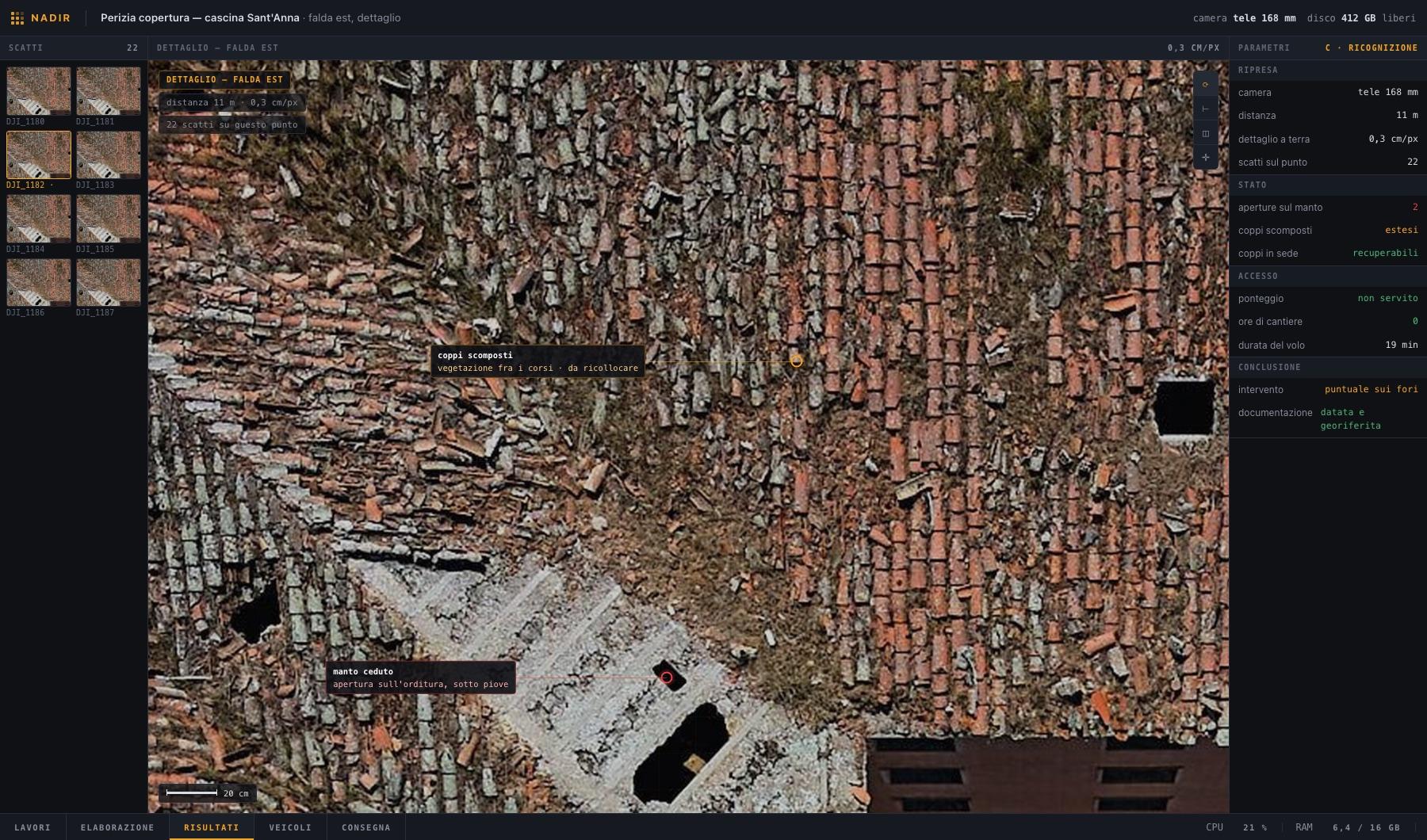
The failed covering, the scattered tiles and the vegetation grown between the courses. That is the difference between quoting a whole new roof and quoting a spot repair — settled with nineteen minutes of flying, no scaffolding and nobody sent up there.
The underside of a viaduct
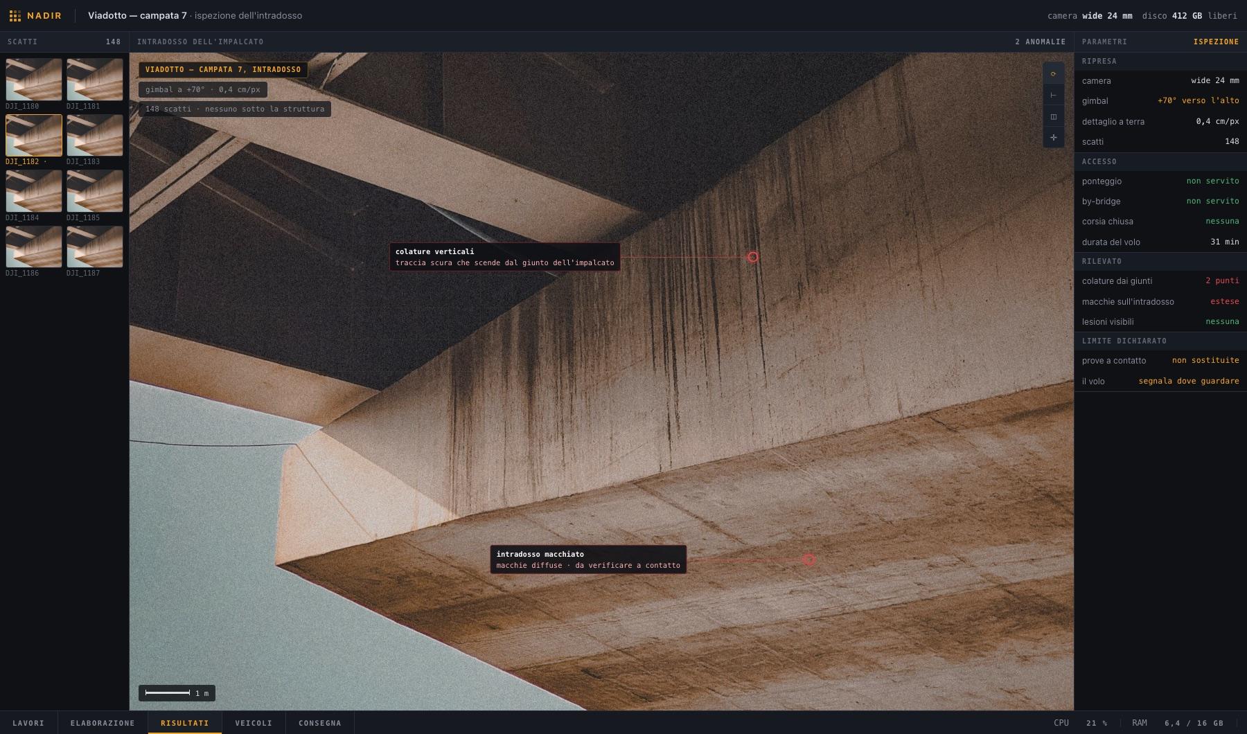
The gimbal tilts to +70° and shoots under the deck: vertical water streaks running from the joint and widespread staining on the soffit. No scaffolding, no under-bridge unit, no lane closure, thirty-one minutes of flying.
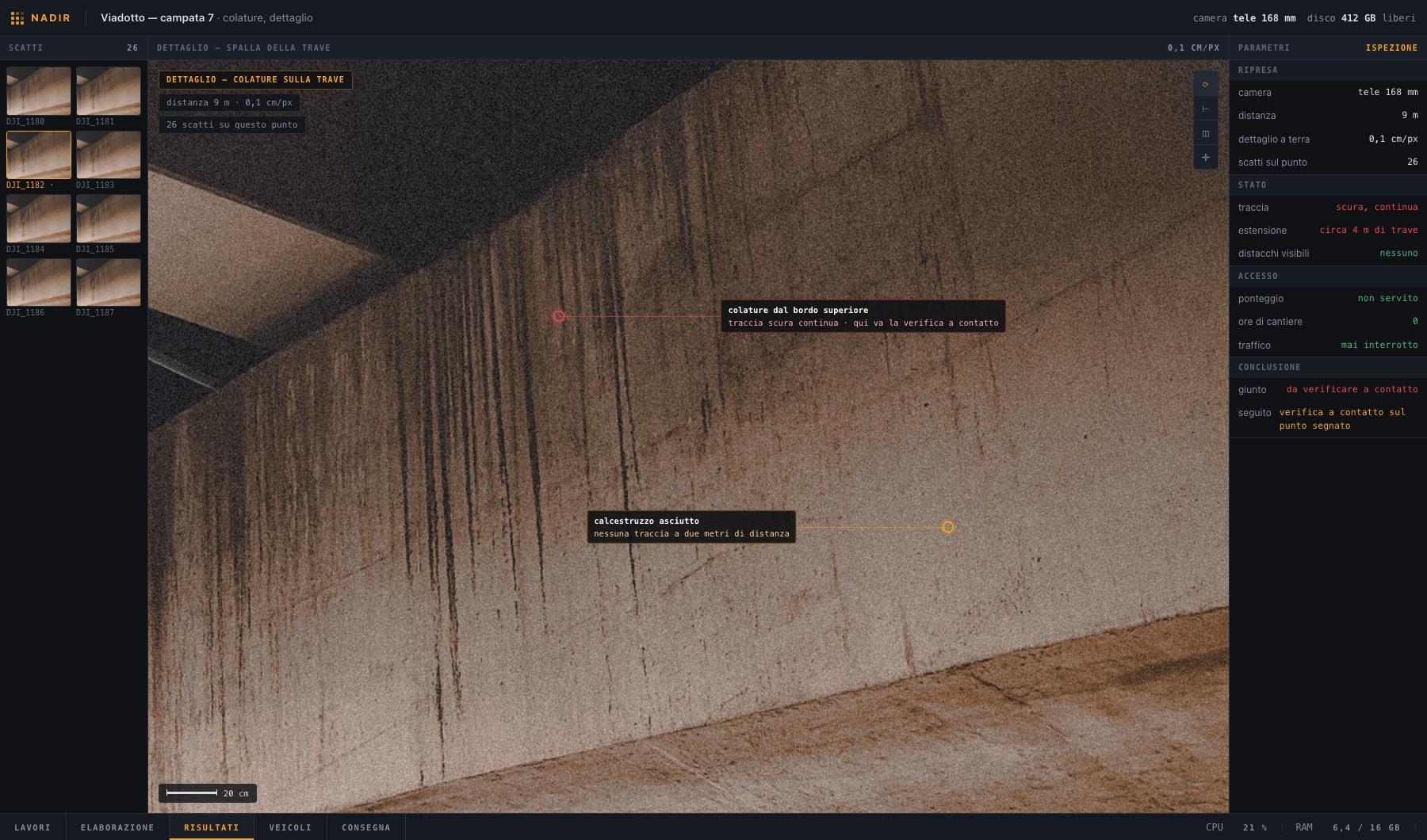
The water ingress up close
On the left the continuous dark trace, on the right dry concrete two metres away. That comparison tells you whether the water is coming through today or is the memory of an old leak.
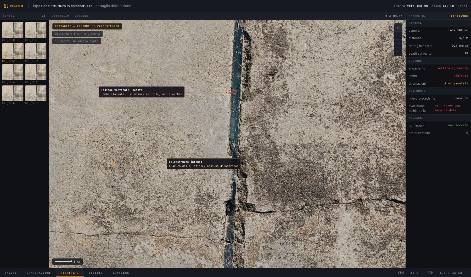
A crack, and what we cannot say yet
An open vertical crack with offset edges, shot at two tenths of a millimetre per pixel. The values panel states the limit: today's width can be measured, its progression cannot — that needs a second survey. A crack is judged on two dates, not on one photograph.
The screenshots show the Nadir interface under construction. The processing and corrections described above are in use; the graphical shell is the part we are finishing.
The photogrammetry engine is not ours, and you should know it: it is OpenDroneMap, free software built over a decade by an international community, with COLMAP and OpenMVS underneath. The radiometric side of the thermal work is DJI's official SDK. What we wrote is the layer above: automation, the corrections alongside, the checks and the delivery. We say so because a public, inspectable engine is one guarantee more, not one less: anyone who wants to can check.
We do not declare an accuracy figure for Nadir, because we have not yet measured it against ground control points. Until that number exists, on jobs where accuracy has to be written into a report we use an already validated chain, and we say so before quoting. The usual rule applies: no figure declared without a measurement behind it.