The studio
Pixel Air
Pixel Air is an aerial survey and imaging studio based in Vercelli. It works across Piedmont and, on request, throughout Italy, backed by twenty years of experience in technical services for live events.
We work for technical firms, companies, public bodies, productions and private clients. Every delivery includes the requested files and the survey documentation: parameters, conditions and limits.
Equipment is chosen for each job and updated over time; the method stays the same.
- No site downtime
- The survey is flown while work on site continues.
- Operator safety
- Roofs, facades and structures are inspected without scaffolding or access at height.
- Client-owned data
- Raw data is delivered with the outputs, with no lock-in or subscription.
- Repeatable surveys
- The same route is repeated over time to compare different dates.
Method
How we work
Timing and costs are agreed before the flight. If a survey cannot be carried out to the required standard, we say so at the site visit.
Brief
We agree with the client the data to capture, the level of detail and the delivery formats.
Flight planning
Route, altitude, overlap and speed calculated; airspace and authorisations checked.
Capture and field check
At the end of the flight we check the data is complete: any gaps are re-flown on site.
Processing and delivery
Files in the agreed formats, technical report and raw data, which remain the client's.
Landnix — Pixel Air proprietary software
Data processing with proprietary software
Images captured in flight are processed with Landnix, the software developed by Pixel Air for orthophotos, 3D models and thermal maps. Processing runs on our own systems, in Europe.
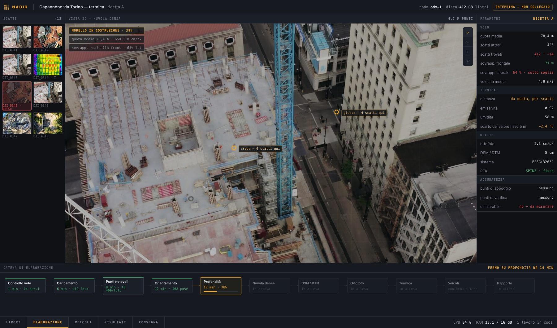
- Temperature corrected for the actual distance of every shot. Standard tools apply a fixed 5-metre distance and, at flight altitude, overestimate temperature by about 2.4 °C.
- Vehicles removed from orthophotos and terrain models once processing is complete, with the ground underneath rebuilt.
- Manual check of every removal before it is applied.
- Flight quality check before processing and a delivery report with the survey's parameters, conditions and limits.
Technical capabilities
Equipment and operating capabilities
We choose the platform according to the job and the sensor it requires. Survey, thermography and video can be captured in the same mission.
Operational
Registered and insured operator
High-resolution imaging
Wide and telephoto cameras to capture detail from a safe distance.
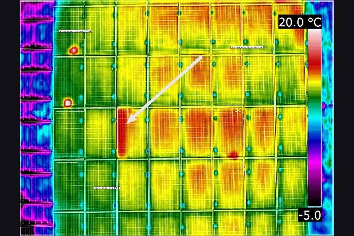
Radiometric thermography
Thermal images with a temperature value for every pixel.
Precision GNSS positioning
Real-time RTK correction and data for PPK processing.
Distance measurement
Laser rangefinder and coordinates of the target point.
Long-endurance platform
Up to about an hour of flight and several sensors on the same mission, to cover large areas in a single sortie.
Cinema capture up to 8K
Full-frame sensor, RAW in 8K up to 60 fps (75 fps in 2.39:1), 14 stops of dynamic range and interchangeable lenses from 18 to 75 mm. A camera approved by Netflix for 4K original productions.
Multispectral sensors
Capture in the visible and near-infrared bands to compute vigour indices.
Field application
Tanks from 40 to 100 litres and working width up to 13 metres, driven by the prescription map.
Repeatable routes
Paths saved and repeated with centimetre precision, for comparisons over time and identical shots on different days.
Parachute and flight termination
System independent of flight control: in a 24-metre fall, impact energy drops from 1177 to under 21 joules (manufacturer's data). It allows operation above controlled areas in urban settings.
Two-operator crew
Separate pilot and camera operator, with dedicated monitors for director and production.
Night operations
Near-infrared illuminator up to 100 metres and colour night vision. At night the thermal contrast of roofs and plants is at its highest.
Qualifications and operating limits
- UAS operator registered with ENAC, with third-party liability insurance.
- European classes C0 to C6 apply to drones under 25 kg and set minimum distances from people; heavier aircraft, such as agricultural ones, require an authorisation. With the certified parachute and flight termination kit we also operate above controlled ground areas. The class is chosen for the job and checked before quoting.
- Open-category operations with prior checks of zones and altitude limits on the national portal. Beyond these limits we apply for a specific-category authorisation, with the related lead times.
- Drone spraying: Italian law has allowed it since 18 December 2025, by derogation and experimentally for three years, but the implementing decree on crops, products and methods has not yet been issued. Until then the service is not active.
- Survey accuracy is checked on ground control points and, when required, stated in the report.
- Every stated value is backed by a measurement.