Deliverables
Deliverables, 3D models and delivery formats
Compatible with the main GIS, CAD and 3D modelling software.
Sample deliverables
What we deliver
Three typical deliverables: thermography of a solar plant, a terrain model and a roof inspection.
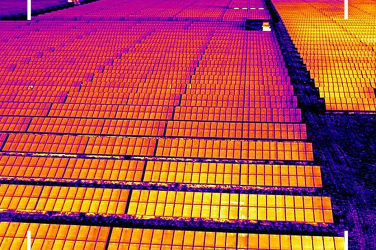
Solar plant thermography
Faulty cells and strings identified on a radiometric map.
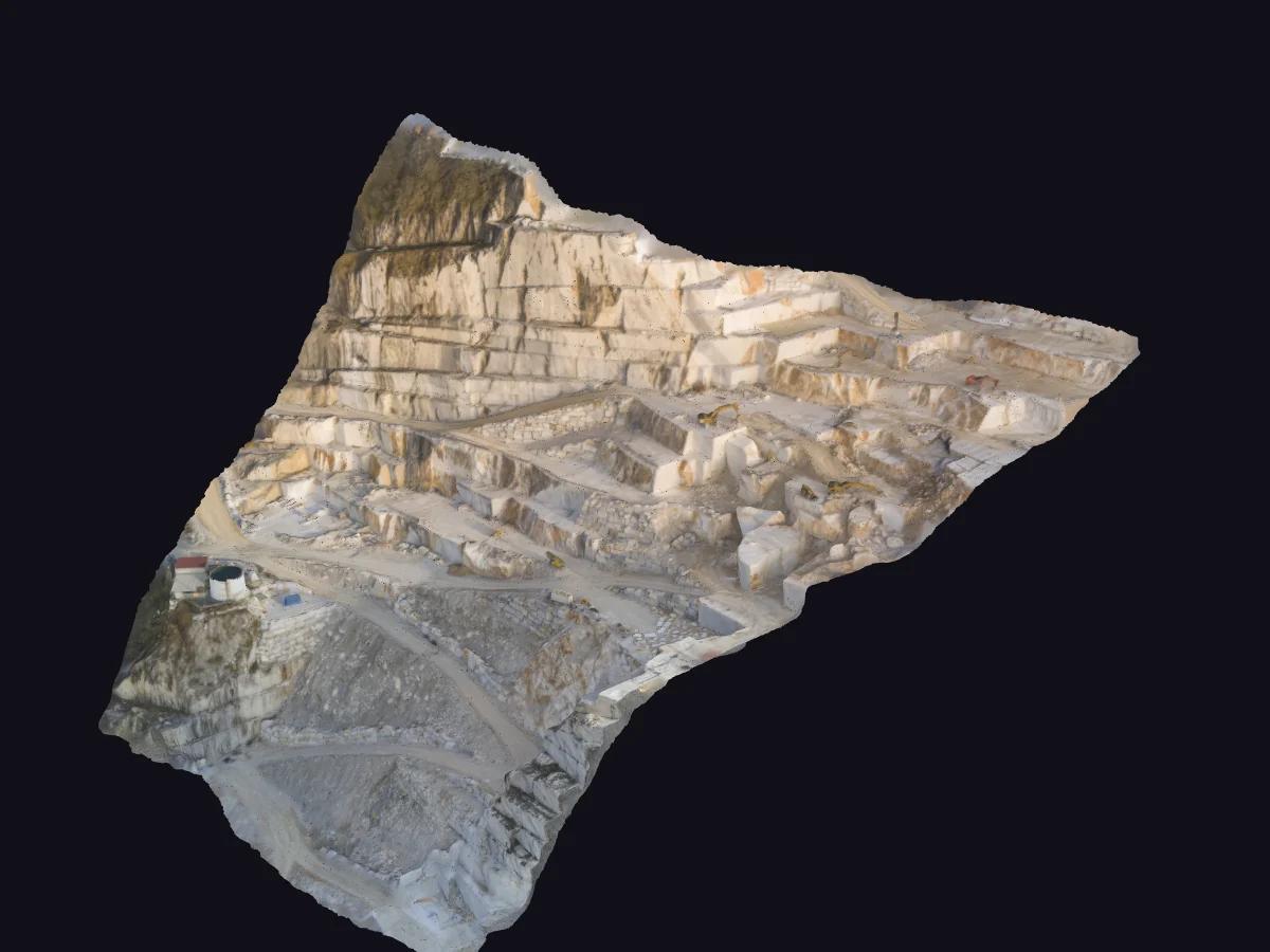
3D terrain model
Digital elevation model for sections, slopes and cut-and-fill volumes.
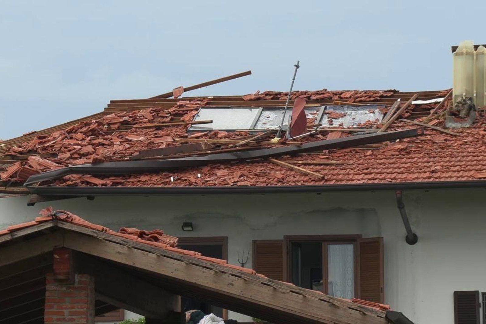
Roof inspection
Lifted tiles and cracks recorded without scaffolding or access at height.
3D models
Navigable 3D models
Examples of models reconstructed from drone imagery: rotate them with the mouse or a finger.
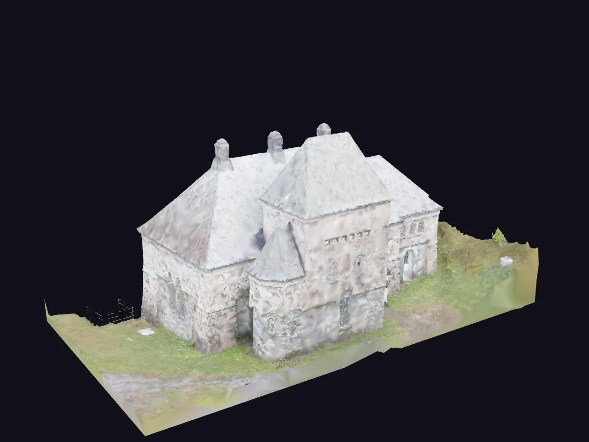
Hydroelectric power station
Building and surrounding ground in true colour, to document the existing condition of a plant.
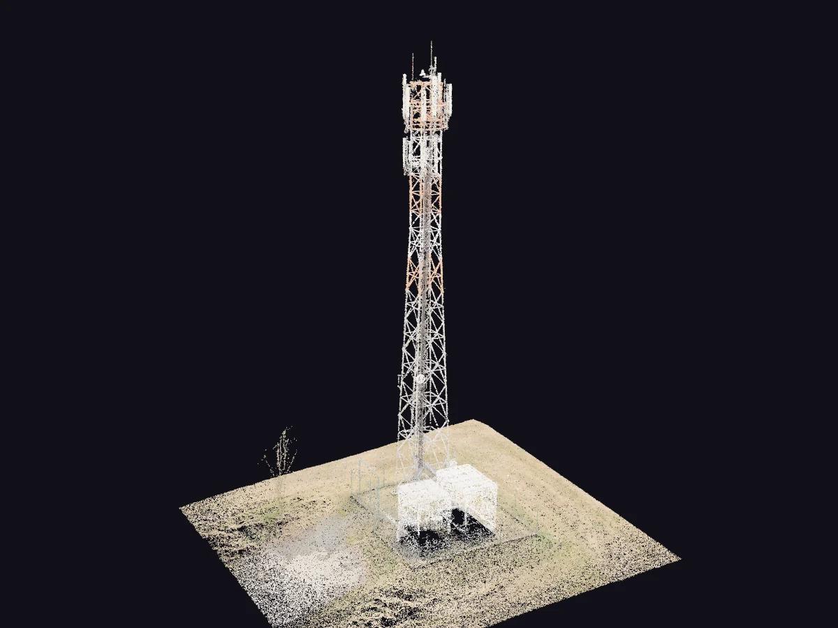
Telecommunications tower
Coloured point cloud: every point has coordinates and colour, for measuring heights, verticality and clearances.
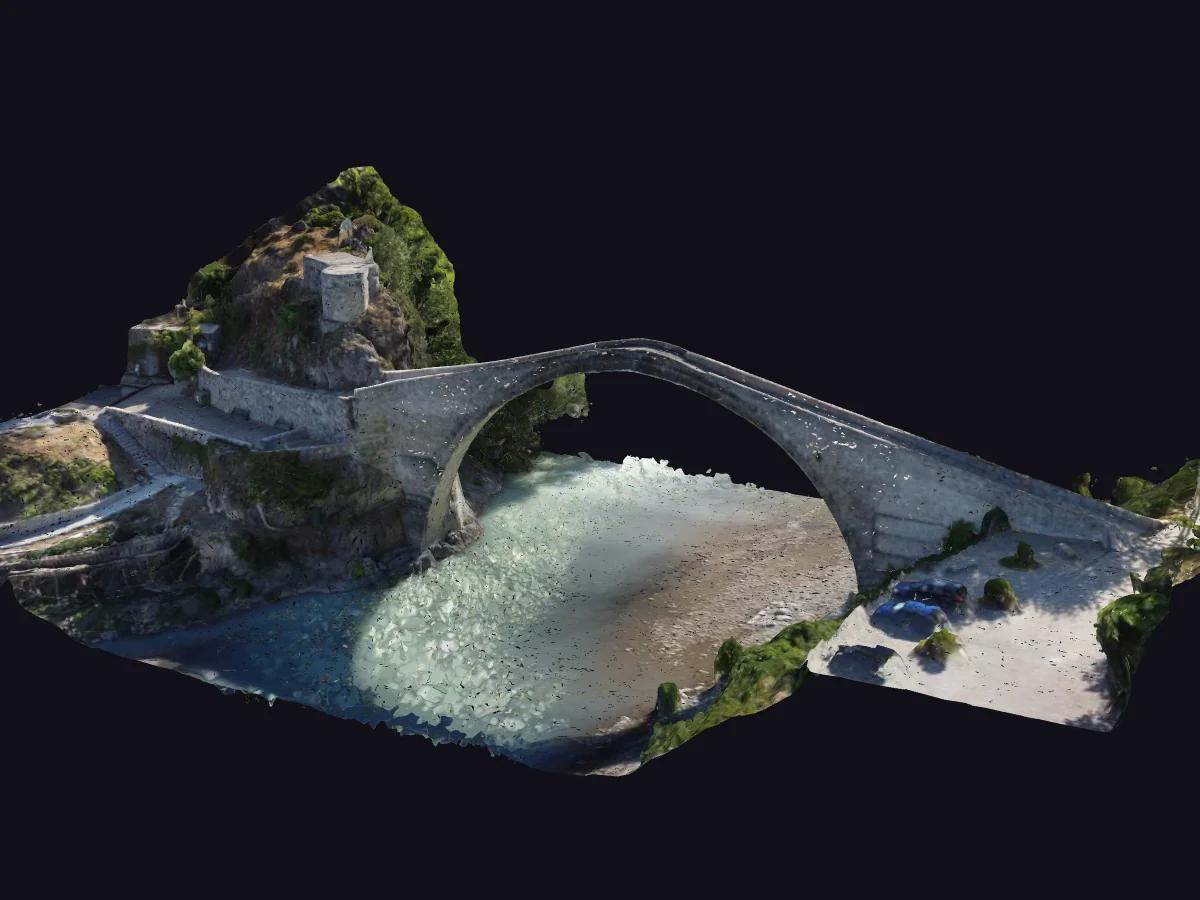
Stone arch bridge
Textured model of the bridge and riverbed, for inspection and documentation of its condition.
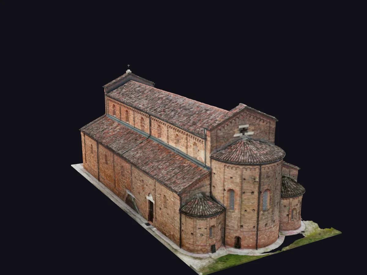
Church
Textured model of elevations and roofs, a basis for architectural surveys and restoration projects.
From our flights
Thermography and search from above
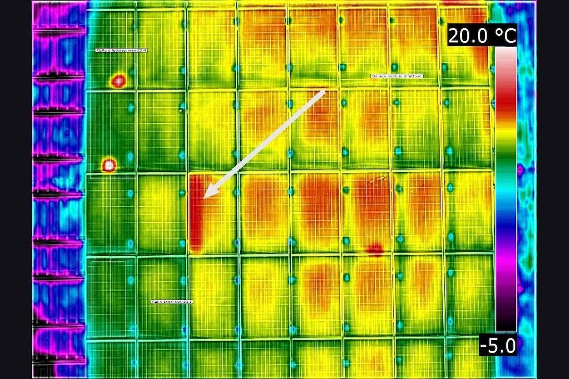
Anomalies classified by module
Pixel Air survey: a faulty cell at 23.4 °C against 10.1 °C on an adjacent healthy cell, a 13.3 °C difference on the same module.
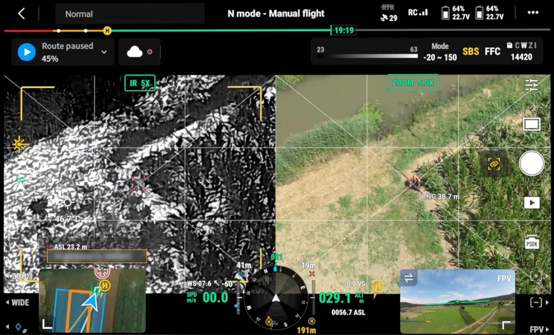
Controller screen during one of our flights
Actual controller screen: thermal image on the left, visible camera on the right, both on the same point. Under the crosshair, 38.7 metres away, a person lies still in the vegetation. Sun-exposed ground reaches 46.7 °C, above body temperature: in these conditions the person appears dark in the thermal image rather than bright as at night. Coordinates have been masked.
Delivery formats
Compatible with the main GIS, CAD and 3D modelling software.
Orthophoto
Georeferenced GeoTIFF and JPG
GIS mapping and CAD drawing
Terrain models
DSM and DTM as GeoTIFF
profiles, sections, volumes
Point cloud and 3D
LAS/LAZ, OBJ
measurement, 3D modelling and BIM
Thermography
Original R-JPEG and °C maps
analysis and reports
Video and stills
Up to 8K in ProRes RAW or CinemaDNG; high-resolution stills
editing and print
Technical report
PDF with flight parameters and measurements
to attach to the file